Integrating Community and SFMTA Data
Understanding Why Certain Stops are More Popular
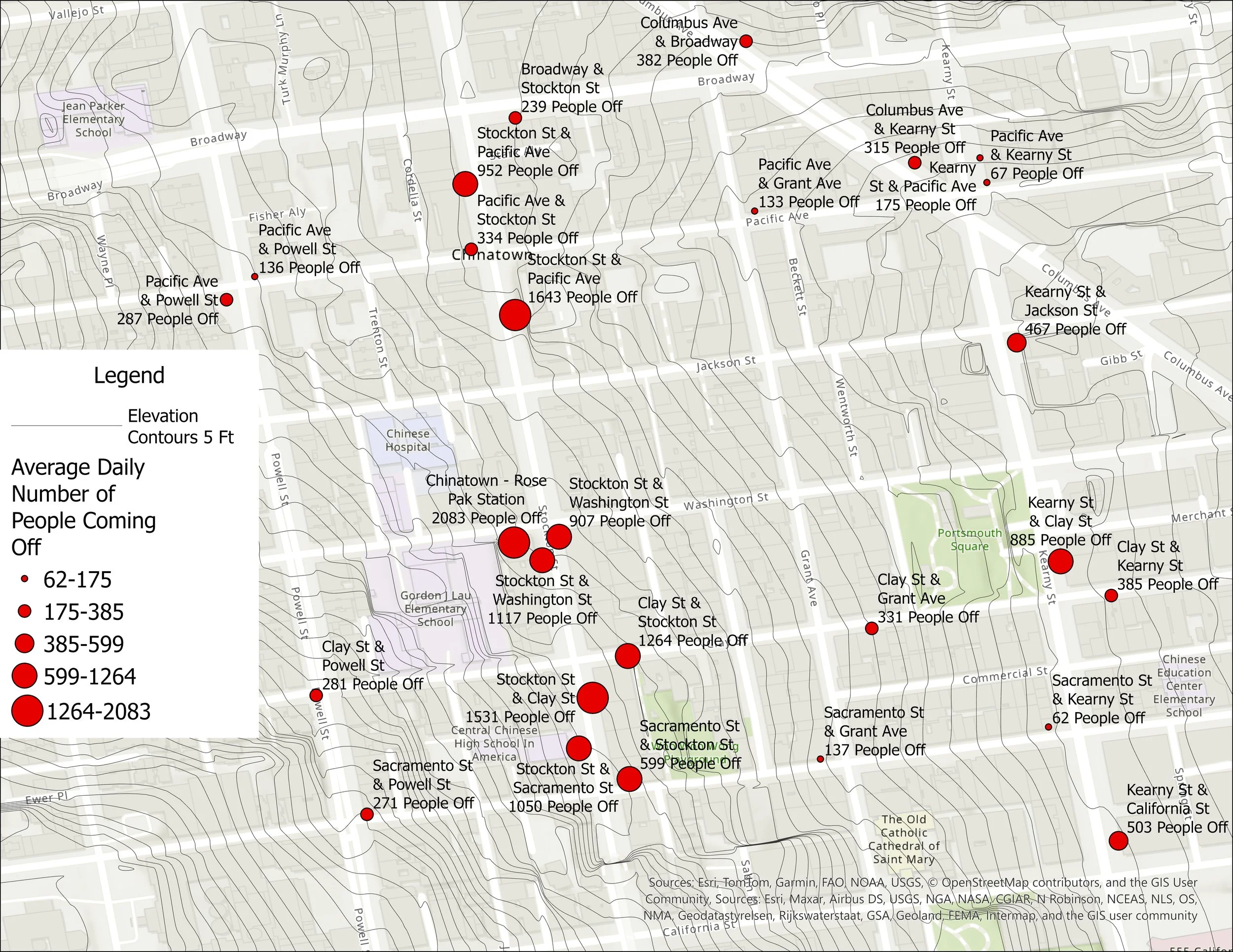
This map illustrates the total number of passengers alighting at each bus stop in relation to Chinatown’s elevation, with contour lines representing 5-foot increments in elevation change. Elevation appears to play a role in influencing where riders disembark.
The majority of passengers alight along Stockton Street, which is relatively flat compared to much of Chinatown. This likely contributes to the concentration of activity at these stops. While Kearny Street is also comparatively flat, it records fewer alightings, suggesting that additional factors are at play.
The distribution of services and destinations within Chinatown also shapes ridership patterns. Stops located near key community services, retail corridors, and cultural institutions attract higher passenger volumes, reinforcing the relationship between transit access, neighborhood topography, and land use.
These findings underscore the importance of accounting for topography and services in transit planning and decision-making for Chinatown.
All icons can be clicked on for additional information.
To expand the map, click on the expanding icon above the magnifying glass at the bottom right.
A legend is provided by clicking on the circular i icon in the top left corner.
To toggle features, click on the icon above the expanding map icon to initiate the "map viewer," where features can be toggled on the option called "layers".
Relationship Between Bus Stop Locations and Services
The map above combines trip purpose data with SFMTA bus stop information to show how the location of services influences ridership in Chinatown.
Most activity is concentrated along Stockton Street, where many of Chinatown’s grocery stores, schools, social services, and health facilities are located. This matches the top trip purposes identified in our surveys: shopping, work, and school.
The 8 line on Kearny Street also sees significant use, particularly at Kearny and Clay Street, near Portsmouth Square Park, a central gathering space for the community. The 8 line also connects to City College and neighborhoods across San Francisco, bringing additional riders into Chinatown.
Overall, these patterns show that public transit is essential for connecting people to the services and destinations that make Chinatown a vital hub for the community and the city.